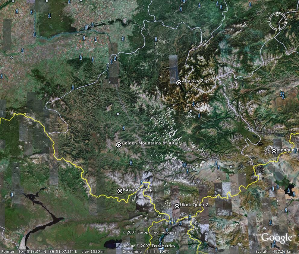
This image from google earth shows most of the Republic of Altai. The yellow lines towards the bottom are the borders with Kazakstan, China and Mongolia (left to right). The mountains are the headwaters for the mighty Ob and Irtysh rivers that eventually flow into the Arctic ocean. It looks like we will be recording a man called Arzhan Kezerekov in a village called Kurota near Ongudai, roughly in the centre of this map. This village is at the base of a valley that leads up to the Golden Mountains. We recorded three old ladies near this village in 2002. Although the Golden Mountains are less high than Mt.Belukha to the south, they act as a spiritual focus for the locals. Incidentally, the Altaian name for Belukha is Uch-Sumer.
posted by richscrase @ 10:37 PM
0 comments
![]()
![]()
0 Comments:
Post a Comment
<< Home